Nine days, two national parks, four national forests, many waterfalls, and less than $400 budget: one of the best trips I have made.
Very good friends of mine spent every vacation they had in northern Colorado and always talked about the state in superlatives only. It motivated me to see it on my own, so in early 2014, I made a road trip to Colorado Springs, Denver, and around. Sure enough, it was fab!
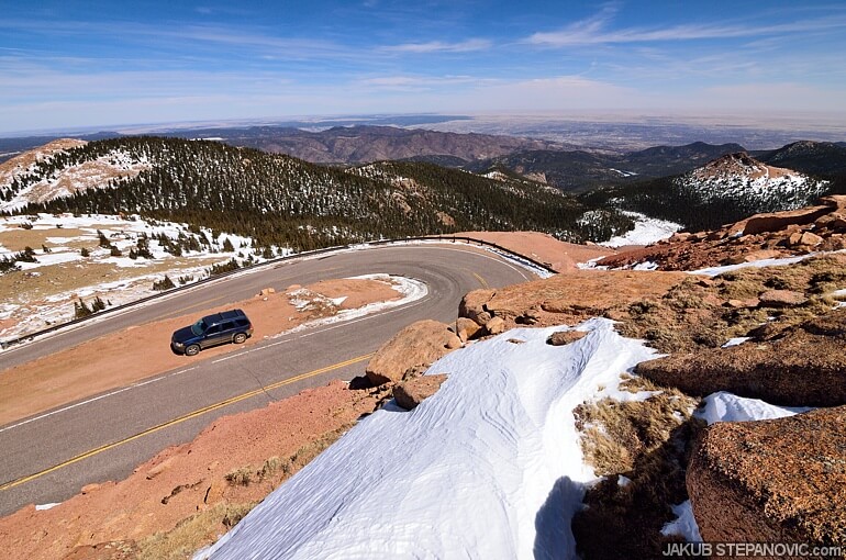
Back then, at Pikes Peak. Great times, right there!
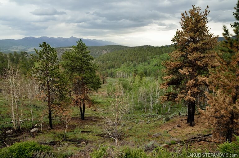
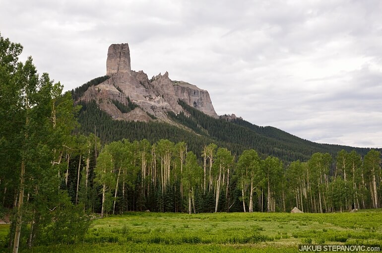
But that's another story. This post is about what followed: The first trip had me wanting to return and explore more; the sooner, the better, so I started planning another road trip just as I got home. Soon, I knew I wanted to explore the San Juan mountains and the area around Crested Butte. I also wanted to spend as much time on off asphalt as possible. With that, the road trip plan quickly took shape.
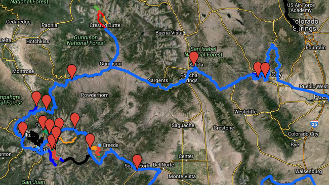
preliminary map
One thing I learned while planning the trip was that many trails I considered driving on would likely be covered in snow until June. So, I had to wait. However, the wait proved a good thing in the end; I had more room to revise the route and add more cool spots to see – such as the Black Canyon of the Gunnison. I even added locations of some gas stations as I knew I'd be out in nowhere, so knowing where I could fill gas could be crucial. Since mid-May, I checked websites that monitor the snow levels almost daily, but it took until the end of June for them to report that the trails should be passable. Let the adventure begin, yay!!
Day 1: Arrival
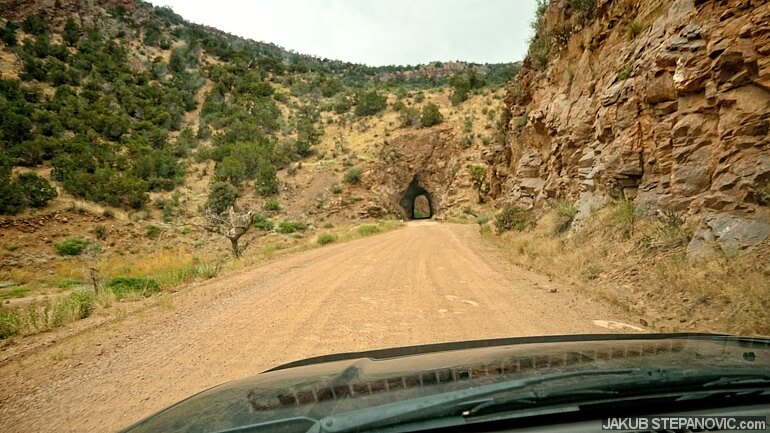
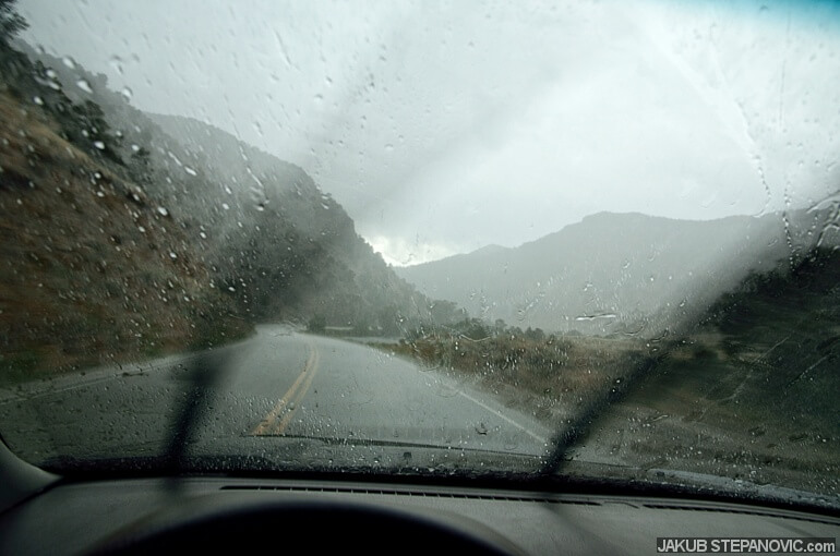
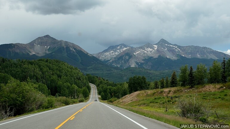
After some hours, I entered Colorado on the US 50, taking me to Pueblo. I checked the city a bit, and since it was the last bigger urban area for a while, I topped up my gas tank and got all the food and water for the upcoming days. (The previous trip taught me that smaller towns charge extra dollars for every foot of elevation you climb into the Rockies.) Stocked up, I headed west towards the majestic mountains, and by the evening, I got into the Phantom Canyon. It wasn't too late, but I camped to enjoy driving further in daylight. The reason for this was simple: the road was the goal – It goes by a neat environment and features some cool tunnels and cliffs. It used to be a railroad track, but once the local mining industry declined, they ripped the rails, and nowadays, it's accessible for vehicles.
Day 2: Start of the Adventures
Phantom Canyon was indeed pretty, so I stepped out somewhere in the middle and went for a short hike. But when I got back into the car, it wouldn't start. Cold sweat covered my face. There was no cell phone service, and this road's traffic was next to none. Yes, those were some factors that made me pick these roads in the first place, but man, it scared me now. Not a single light on the dashboard, absolutely nothing. "Seriously?! I just started the trip.." I thought and popped the hood to see if I could troubleshoot it.
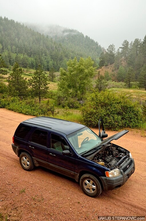
I am trying to repair my car myself. However, about a week prior to the trip, Ford came up with a recall for a part of the steering mechanism, so I let them mend it. One would think authorized dealerships' work does not need to be doublechecked by an amateur like me, yet guess what: they didn't reconnect the battery correctly, so it rattled out on the bumpy road. Unbelievable. But at least it was an easy fix. Phew!
This sorted, I went up the hill to see an old mining town, Victor. Once the second-largest gold mining district in the US, it only has a population of around 400 now.
-

- Victor’s downtown.

-

- Mining reminders in the countryside.

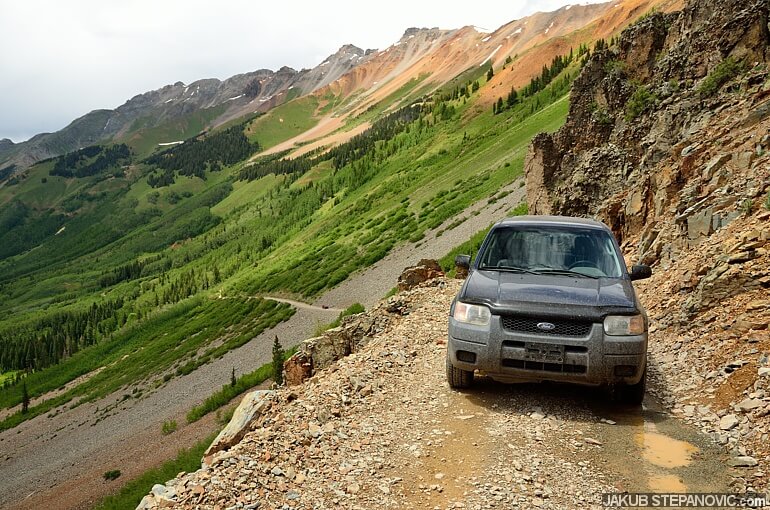
My next stop was the Royal Gorge. To get there, I drove down the hill via Shelf Road that follows Cripple Creek and the canyon it made. Some folks I spoke to in Victor warned me that Shelf Road is utterly terrifying. Well, it's named a shelf road for a reason, but it is wide enough to pass an oncoming vehicle and has a good surface. I'd call it "fun to drive" instead.
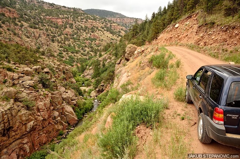
But I had one scary moment: some guy came faster than he could handle out of one curve and slid right against me. I slammed the brakes, and we missed each other by inches. Another phew!
Car sliding at you on one side, a cliff on the other.
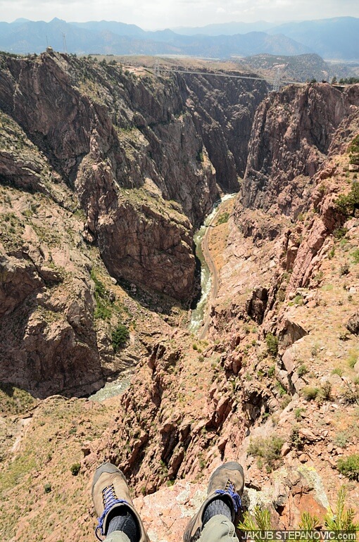
I went to the Royal Gorge because of the bridge that connects its shores – which are divided by a 955ft (291m) deep gap. Since its competition in 1929, it has been the world's highest bridge for over 70 years and is still the highest in the US. I love engineering marvels like this! Unfortunately, the area was still recovering from a devastating wildfire last summer, and the bridge was closed to the public. (So was an amusement park next to it, but I couldn't care less about that.) The gorge looked great anyway, so I took a hike around and soon found a spot with a grand view of the bridge.
snack time!
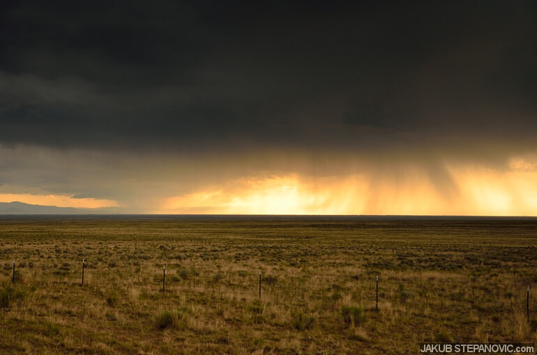
After this one, I kept going west to reach higher mountains; but first, to see another technical goodness: a smokestack of the former Ohio-Colorado Smelting and Refining Company in Salida was the next stop. On my way there, the surroundings got greener, the hills steeper, and a massive storm came by.
It wasn't pouring as hard when I pulled into Salida, but it still rained some. I got myself a burger, backed up my photos, and by the time I arrived under the stack, the rain was gone.
-

- 365ft of glazed bricks and mortar. built in 1917
-

- wish I could climb that.
I used to climb old stacks like this back in Europe, and I've great memories of it.
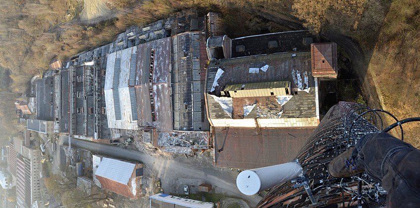
Here's one from ages ago, some 246ft up. Anyway, back to Colorado..
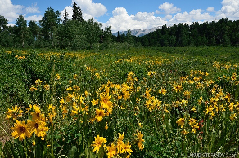
With the rain over, it was time to get off paved roads again. I went to O'Haver Lake.
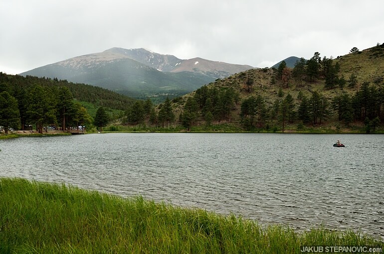
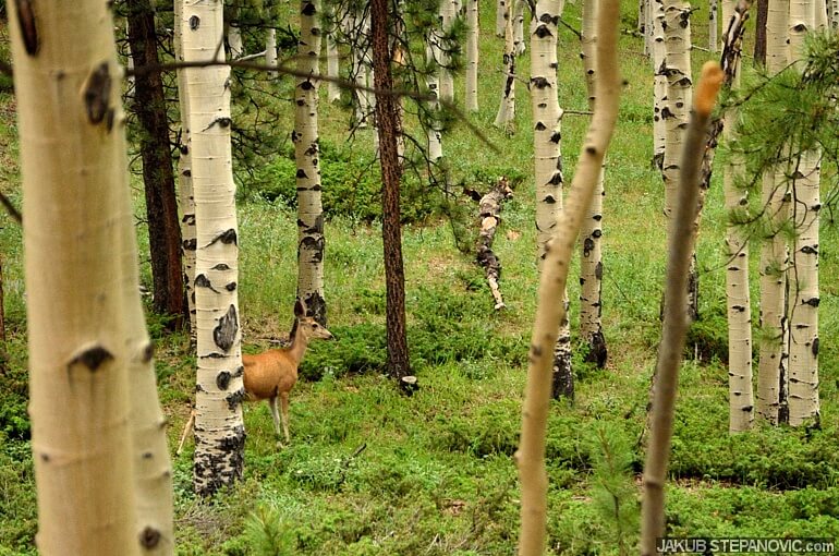
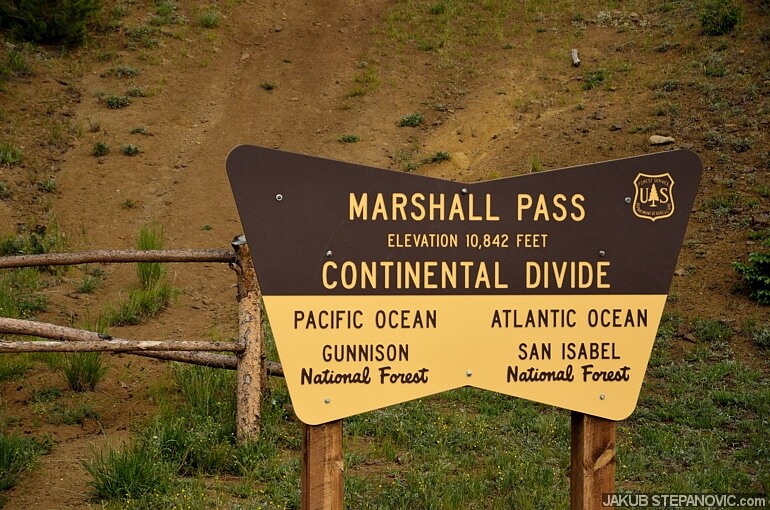
It was nice up there but with tons of people. I was more in a mood for the solitude of the mountains, so I took off soon in the direction of the continental divide via the Marshall Pass. Just like that, the herds of people were replaced by deer. I counted how many of them I'd spot from my car but lost track when I got past 15.
Shortly, the scenery was even better than at the lake..
..and after more driving, I was at the hydrological division. It's like standing in Greenwich and jumping between the west and east hemispheres: It doesn't make a life-changing difference, but it is still interesting and fun.
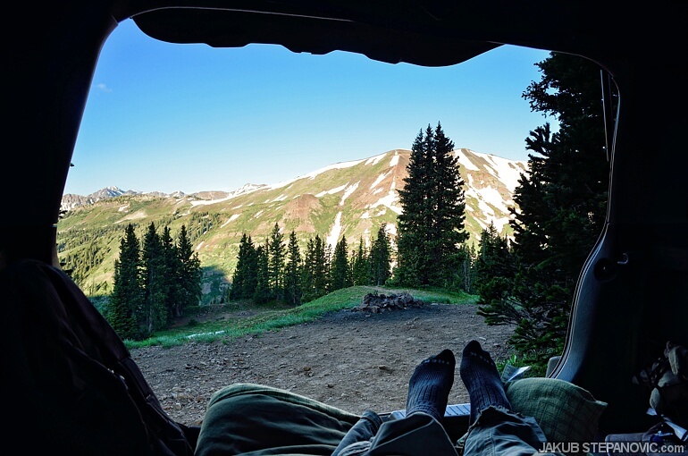
By this time, it was already getting late. I drove a bit further and found a nice spot to sleep, still within 10,000 ft elevation. As I brushed my teeth, a light rain started coming from the sky. It created nice background music to fall asleep into.
Day 3: Entering Paradise (Divide)
I started by descending from the Marshall Pass. The trail mainly went through woods without some extensive views. Still pretty, though.
Like the Phantom and Shelf roads, the Marshall Pass was quite easy to drive on. It was rockier in places, but there were no challenging spots. Yet, something got adrenaline pulsing anyway: the forest service transported logs for processing. Passing a car was fine, but a 10-wheeler rolling in speed, now that was close!
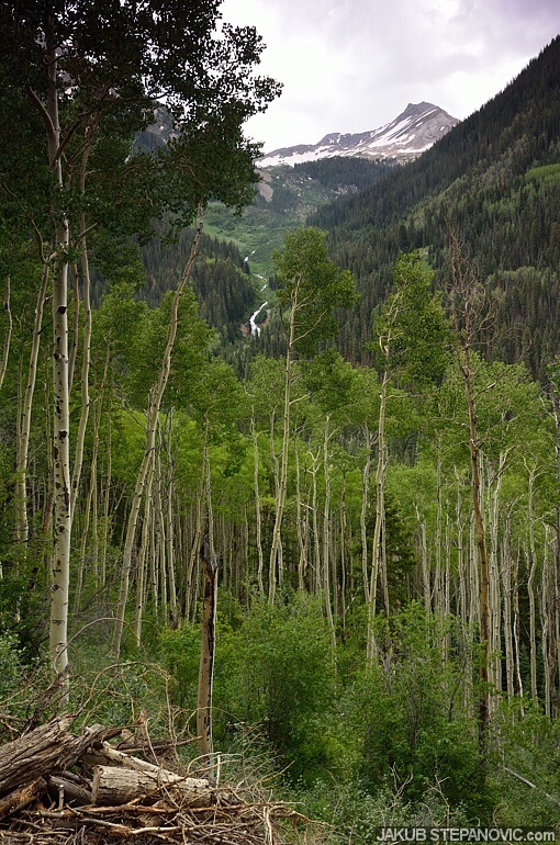
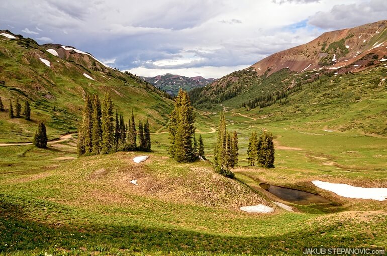
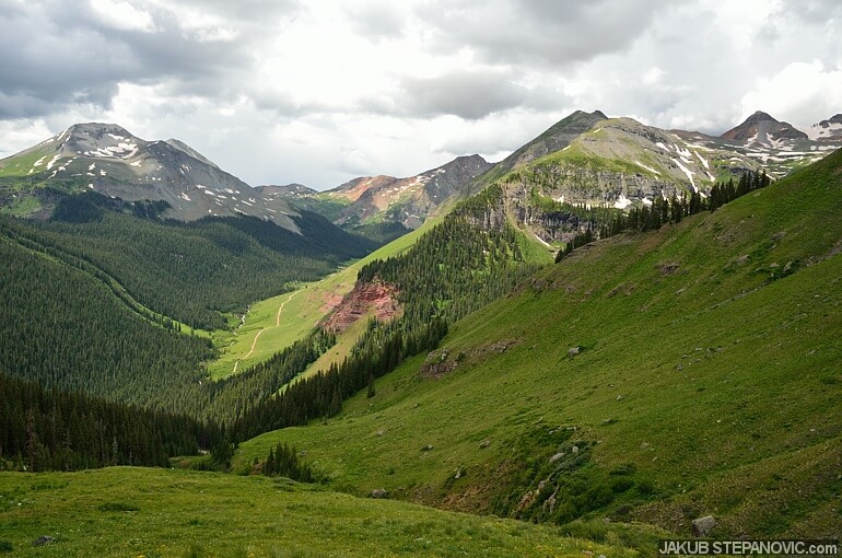
The surroundings changed extensively on this trail. On its west side, it seemed more moist and vital compared to the dry east. It was also my gate to the higher grounds because I went to the Crested Butte from here. I had to drive on a paved road a little, but it went very quickly. In a while, I was off the asphalt again with incredible landscapes around.
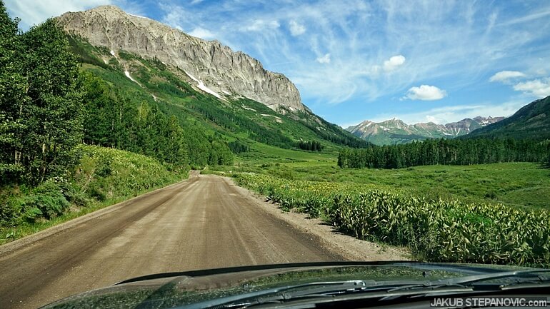
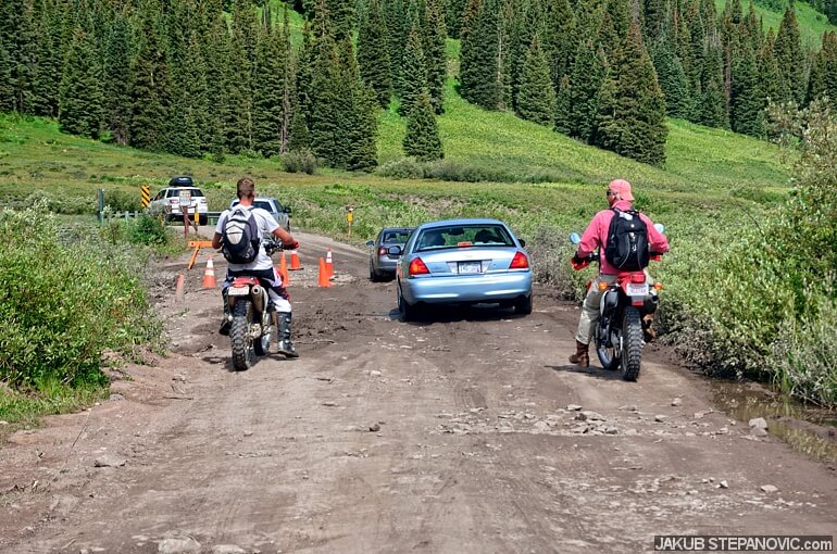
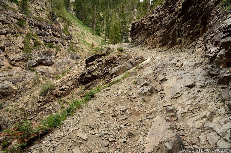
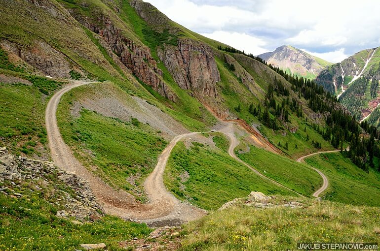
I entered a valley behind the town, intending to climb up towards Schofield Pass. At first, the road was wide and smooth like a normal highway, and people were all over—many campers, bikers, hikers, painters next to the road, etcetera. Once I passed the village Gothic, the trail became a bit rougher, enough to cause issues for some low-ground-clearance cars: Someone picked a line that scrapped the underneath of their vehicle. The following sedan avoided the rocks but got stuck in the mud, and I ran into a traffic jam.
By the time the trail started to ascend, I had it almost all for myself. Brilliant! It got steeper and narrower, and it didn't take long before I got to a section covered by a decent snowdrift.
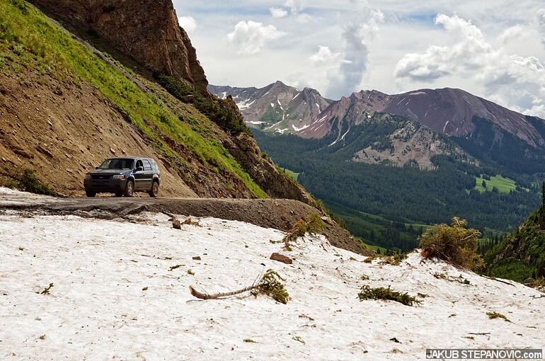
The good-sized gap to the edge got covered by snow. It was thick enough to keep the weight of some branches and me as I took this picture, but if a car slid off the trail, it would be a game-over.
Although there were a few tracks of chunky off-road tires in the snow, they were made by rigs with generous ground clearance and, I'm sure, a 4x4 drivetrain. As I lacked these features, I took a shovel from my booth and started clearing the trail. It was a good workout, and after a tad over half an hour, it was good enough for me to get through.

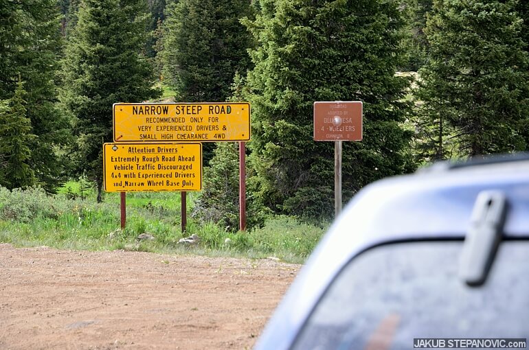
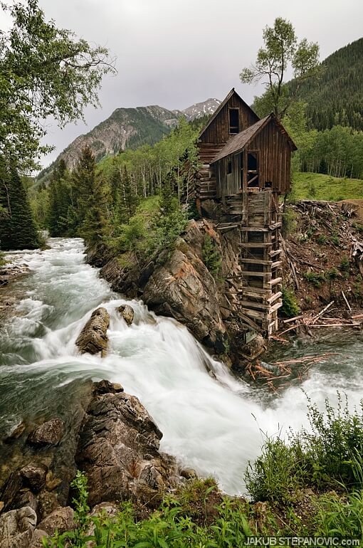
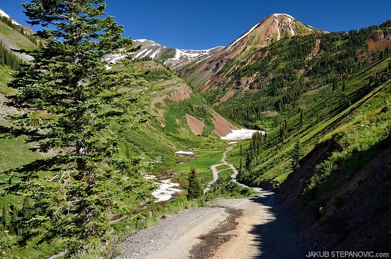
The trail was in great shape from here, so I got over the Schofield Pass (10,707ft above the sea) without issue. I planned to descend a bit over 10 miles on the other side towards Crystal, a former mining village with a wooden mill from 1892. When I prepared for the trip, I noted that the road surface should be passable by car for another mile or two, and then I'd have to go on foot. I was correct on the road's surface, but the gradient was steeper than I had expected. I found that, of course, as I drove down. I was in the first gear and still had to brake a lot. "Dear, oh dear, I hope I'll be able to climb back up," I thought the whole time. The road leveled after some time, and soon, I reached a sign informing me that the trail further was mayhem. Time to park and hike the rest.
It was a good call, as there were spots on the trail that would kill the Ford instantly.
After these rocky sections was a spot where the trail crossed a river. It looked like there used to be a bridge at some point, but it was long gone. The only way at the moment was to wade through. The stream was about two and a half feet deep, but the water was clear, so I could see where I was stepping, and it was a pleasant diversion.
Besides me, there was nobody around and the scenes were just astonishing. After some walking, I reached my goal, the old mill in Crystal. A short storm rolled in, but the place was as cool as I imagined!
Then, I hiked back on the hill again. It wasn't as far, but it sure was steep in places. Also, due to the storm earlier, fording the river was substantially colder and deeper but still fun.

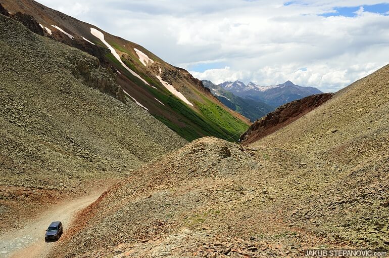
I had to take a break once I got up. Besides catching my breath from the uphill hike at this elevation, I had to brace myself for driving up to the pass again. I set off, and with my eyes glued to the road and the engine temperature gauge, I managed the climb up with no issues. At that time, I had no idea I'd be driving over many similar or worse slopes very soon. I planned to see a place called Paradise Divide, and I followed a trail through the local wilderness to get there. Steeps, rocks, mud, water crossings. and views, it had it all:

So. Much. Fun!
Note the trail. Yes, I drove on that. Yes, it was awesome.
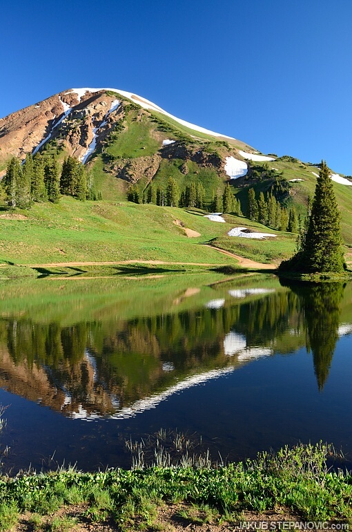
Once I got to the Paradise Divide, I had to admit that the name is appropriate.
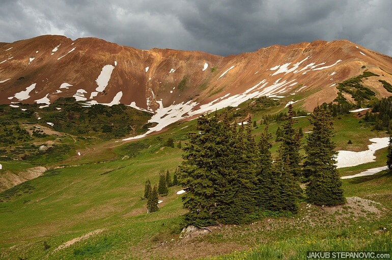
Given the views all around, I just parked and called it a day.
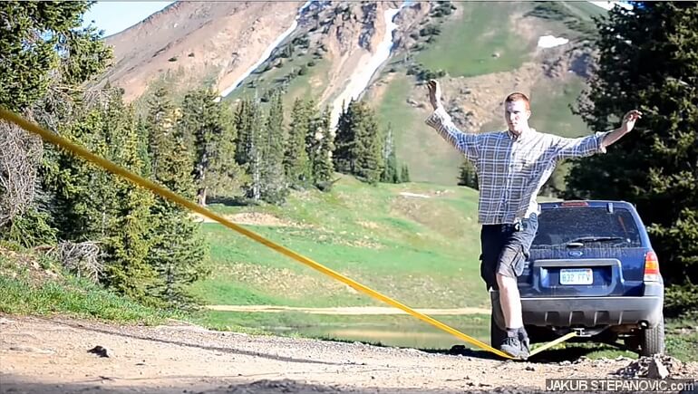
Ford commercial
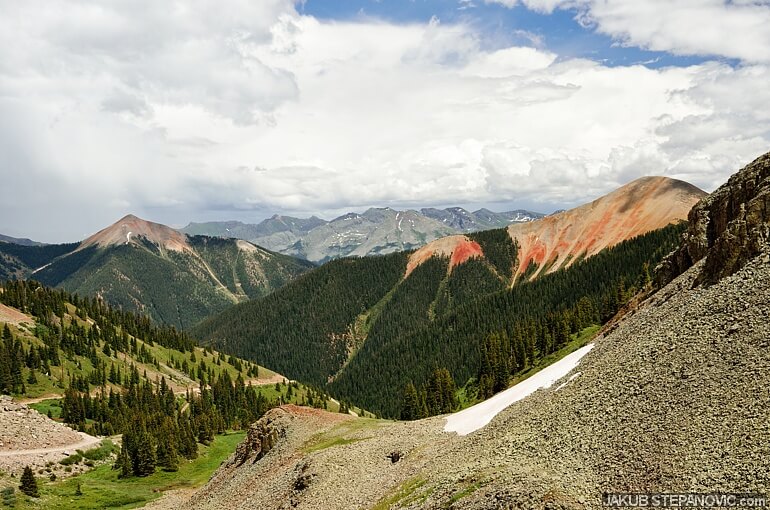
Day 4: Mountains-Deserts-Mountains
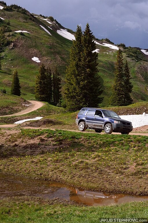
Sleeping at over 11,000ft was great, and really – how could anybody be anything but happy when the first scene after you open your eyes looks like this?
The sky was completely clear that morning, and the early sun made every color more saturated, and every hill around look more 3D.
Yep, not a bad way to start a day. The place, weather, air... it was all too cool there to just leave right away, so I pulled another recovery piece of equipment I took with me from the trunk, this time only for fun. It was a recovery strap, which I stretched between the car and a tree to do a bit of morning balance exercise.
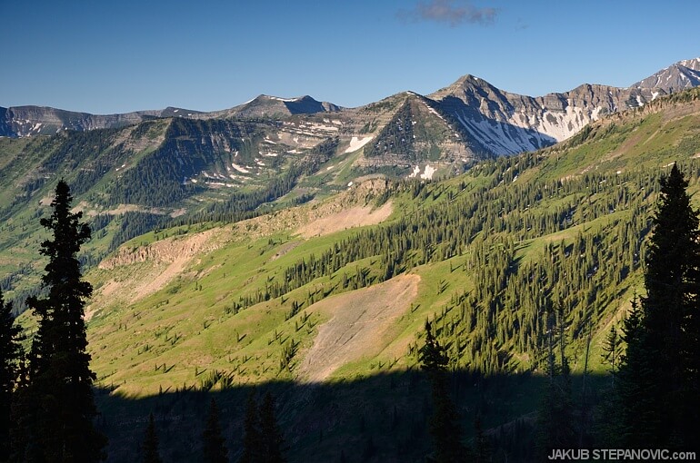
Then I hit the road again, which was also exciting because the trail was supposed to drop to another valley soon. When I planned the road, I checked the contour lines on the map because I wanted to pick the traveling direction that would be steeper downhill instead of up – since I didn't have a low-gear train, climbing over some rocks at some steep slopes would be trickier than going down over them. For the road I planned for this morning, I saw the contour lines dense, predicting that it would be steep and scenic. And boy, it was!
The road in the valley was short, and I entered a highway towards the Black Canyon of the Gunnison within a moment. To my surprise, several of its miles weren't paved either. But compared to the trails earlier, this was wide and smooth like it was made for a Boeing to land on. Even when it turned to pavement, it was fun, and it went by quickly. Before entering the canyon, I was in a totally different environment again:

Earlier that day, the ground was a green carpet with flowers and such, whereas I was in a desert-ish area by lunchtime. Still very pretty, though. Everything just worked well. I even tuned in to some FM radio I was happy to listen to! It didn't take long, and I passed a sign towards the canyon, and I was on a dirt road again, which took me straight to this wonder.
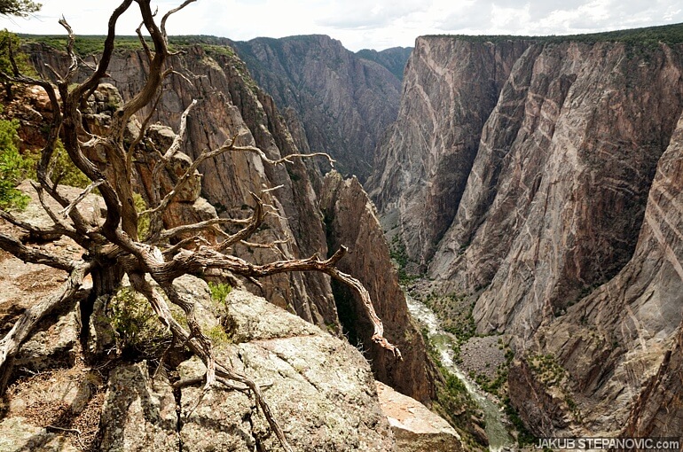
What a place!

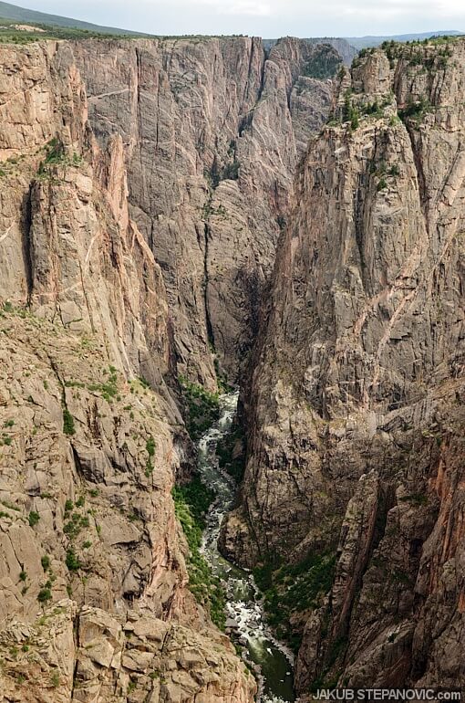
I've been to the Grand Canyon and Palo Duro, but this one impressed me to a point the others didn't. It was staggeringly beautiful, not crowded, and with neat trails all around.
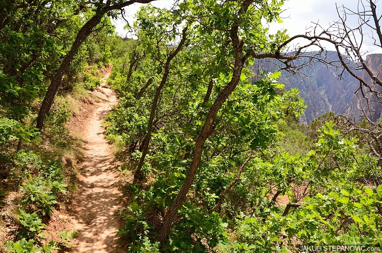
This spot checkmarked off the list, I headed south. The geological features next to the road were cool...

..and so was the road. I had it all for myself and I enjoyed driving every single mile of it.

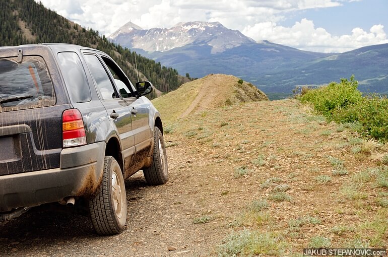
Aiming straight south, I was going to enter another mountain pass, Owl Creek, which would take me toward another highlight, the San Juan Mountains.
-

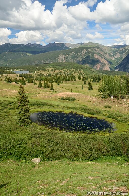
- Blue Mesa Reservoir along the way.

-

- Evening at the beginning of the Owl Creek Pass. Sharp peaks of San Juans in sight!

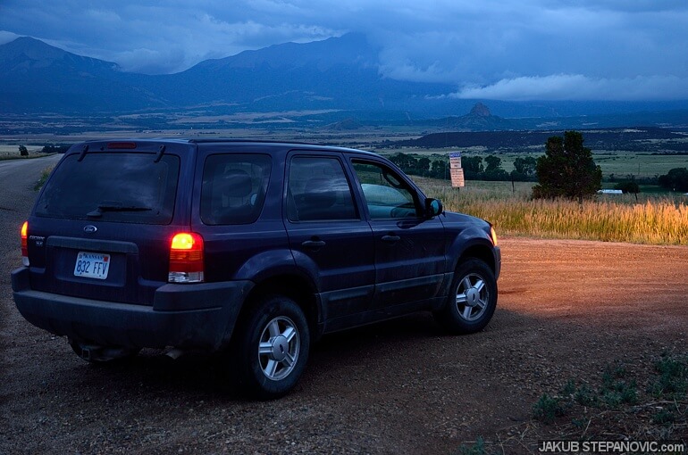
The timing was sweet, as it got dark just a few miles after the trailhead. Keen to see the trail tomorrow, I pulled over to get some sleep.
Day 5: Grand Entering of San Juans

I hit the pass at the next daybreak. The trail was, again, entertaining to drive, but the scenery was a tad behind its competitors until it climbed out of the forest to make for some sweet views:

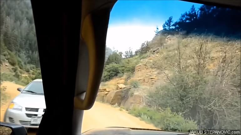
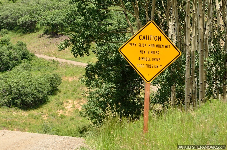
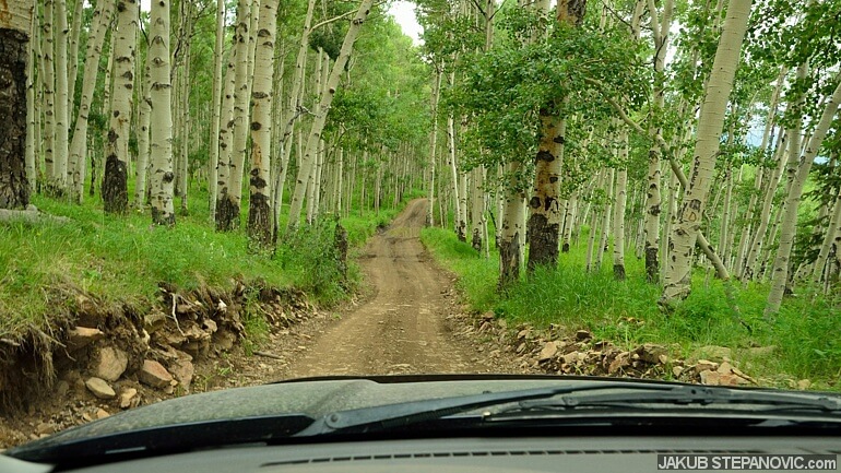
And what felt like no time, I was behind the pass in the town of Ridgway. Here, I filled my gas tank, cleared windows from mud and dust from previous trails, and went straight for another one – The Last Dollar Road. It started like an innocent dirt road, but soon it was a rocky and steep trail, wide just enough for one vehicle. To pass another, there were designated areas every once in a few miles. But all was well. I was alone most of the time, and importantly, the trail had plenty of stunning landscapes to admire.
You and your car. Exploring places you've never been. It is up to you whether you will drive or stop and take a left or right at the fork. Nobody tells you where to go or what you should do. But there's also nobody to pull you out of trouble if you get stuck or lost. Your choices, your responsibility. Distant views with no other human in sight. In fact, no human scale either. Just you, fresh air, and natural beauty. A strong sense of freedom; that's what I felt here.
As I got over the pass, some rain went through the area. This predicted some challenging times as I remembered the sign from the beginning of the road:
Sure enough, the next of those passing places was one big mudhole. I avoided most of it by driving on the edge and planned to keep descending. However, a few curves further, a big SUV popped against me. It is an unwritten law on these roads that the climbing vehicle has the right of way, so I started reversing uphill back to the passing point. That itself was quite a task, but the real problem was that I had to back straight into the mudhole to let the SUV go by. Thankfully, with some gentle steering and throttle work, I got out into the last section of this trail; it was the roughest, and the pleasant sighting was also in superlatives.

Just like every pass up to this moment, the Last $ Rd also took me into a different world. At the end of it, the mountains were taller and more colorful than anything before.

I skipped Telluride, filled with some humongous properties, and joined the amazing State Highway 145. Seriously, it could go in a dictionary along a "Proper Driving Road."
Southbound SH 145.
Still, this trip was more about dirt roads. So, I stayed on SH 145 only for about eight miles. After that, I left the asphalt to drive over Ophir Pass to another old mining town, Silverton. As I mentioned, I tried planning the trip to have off-road uphills easier than downhills, and so far, it has worked exactly like that. But Ophir turned out to be the opposite.
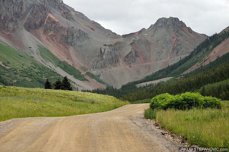
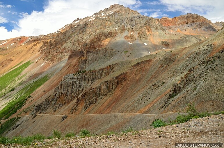
See the diagonal line across the mountain? that's the road.
The trail from the village to the pass has only three miles (less than 5km), and one gains some 2000 feet (over 600m) in elevation.
The gradient was mixed with a rough surface, making a recipe that cooked into something, which put me and the car out of our comfort zone.
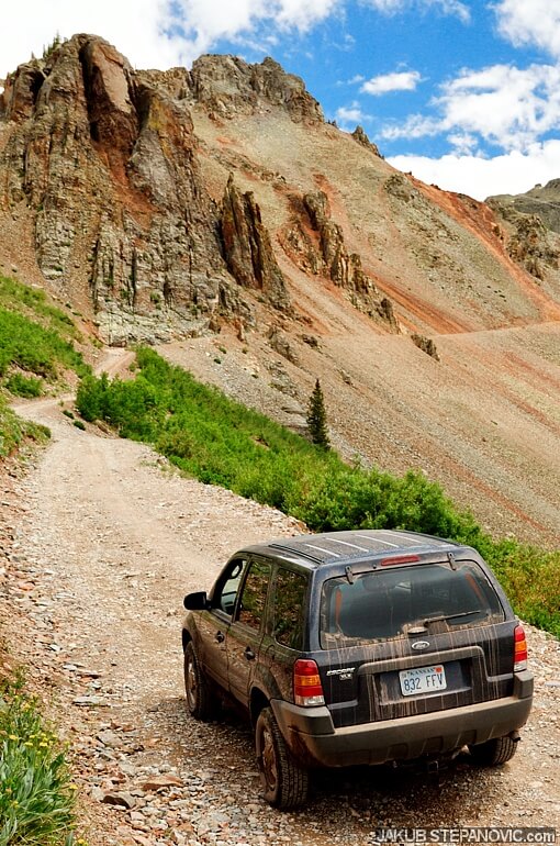
The last portion before the pass was just a pile of big rocks all over the trail. I was slowly making progress until there was a segment with a large hole right where the optimal lane would be. It was big enough that I couldn't drive through it due to my ground clearance, so I had to go all the way to the edge of the cliff to get past that. (No way of turning back at this point). As I was at the outer limit of the trail, a few rocks loosened and went down the cliff. All the sounds were clear; I had my windows down to watch and hear things better. Still ascending, the front wheel on the passenger side suddenly hit a big rock, and the car stopped. Uhhh!
I added a bit more gas, but that resulted only in short wheelspin. It was exactly the moment I could use differential locks or some traction control witchcraft, but lamenting about stuff I don't have has never solved an immediate problem. I had to concentrate on the bits the car had to overcome this issue. The idea of getting stuck here was scarier than the dropdown. Speaking of which, more rocks went down. "I better get out of here!" Gentle work with the gas pedal achieved nothing this time, so I hit it hard. A smell of burnt rubber quickly penetrated the car's interior as I jumped upwards over the big rock. A part of me was concerned about the tire, but I didn't want to lose momentum, so I kept rolling over the last yards. There weren't more major obstacles in the way, and I successfully reached the top.
Just as I did, I parked and went to check the tires and the Ford's underside. Nothing broke! That revealed I got back in the car to sit for a few minutes, just relaxing all the excitement. Then, I was about to leave for a walk around the pass when a pickup truck came the same way I did. And just as they parked and got out of the vehicle, the driver started: "Holy sh*t, have you seen that hole, oh my that was tense!" then they noticed me and my lower and less powerful car: "Did you make it this way?" a guy asked and pointed at the side from we came from. "Yes, I did," I said. "No way, that hole, I mean, that hole...!" ~ "I know, I know." ~ "Can I take a picture of your car?" ~ "Go ahead." This done, I did the walk and started my way down the mountain.
That's where I headed
The trail was just as steep but a lot smoother – so it went all right, taking me to Silverton soon.
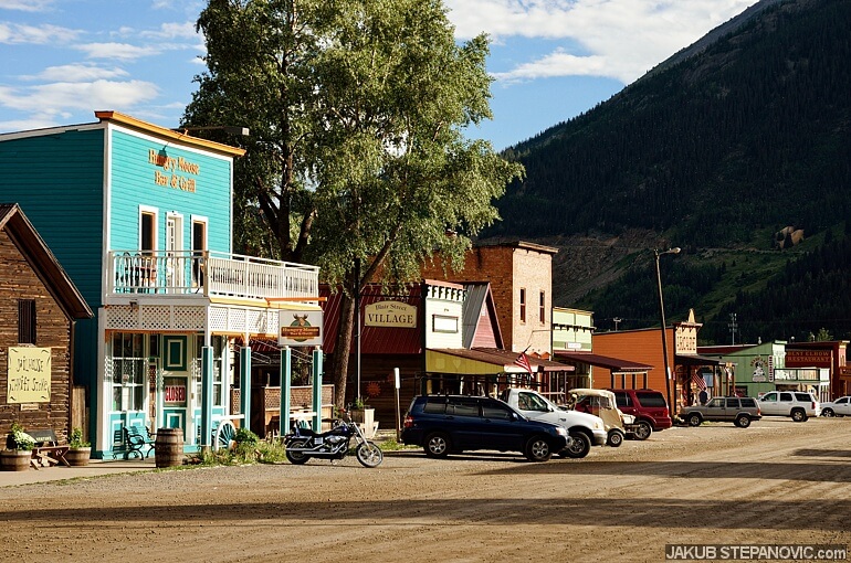
Wild west and 4by4s!
At first, I thought of hiking, but then I decided there were enough thrills for today, so I just explored downtown. It was getting late anyway.

I felt I deserved a treat after the day, so I got a hotel for tonight. The first and only hotel during this trip. Another thing I got that evening was a pizza. Then, I joined locals and other tourists in sharing stories and went to bed later.
Day 6: Alpine Worlds
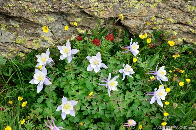
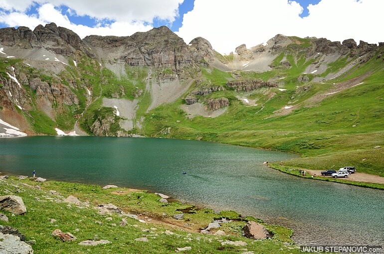
I headed to see Crystal Lake the following morning. One has to climb quite some switchbacks to get there.
Above them await these views...
...and flowers. Everywhere.

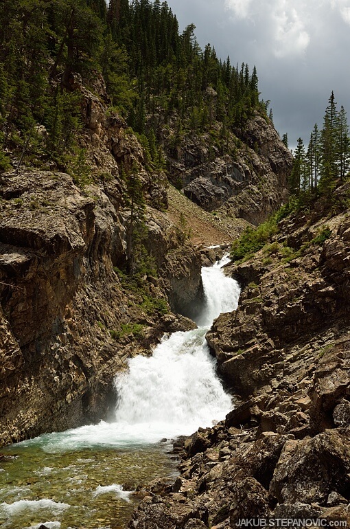
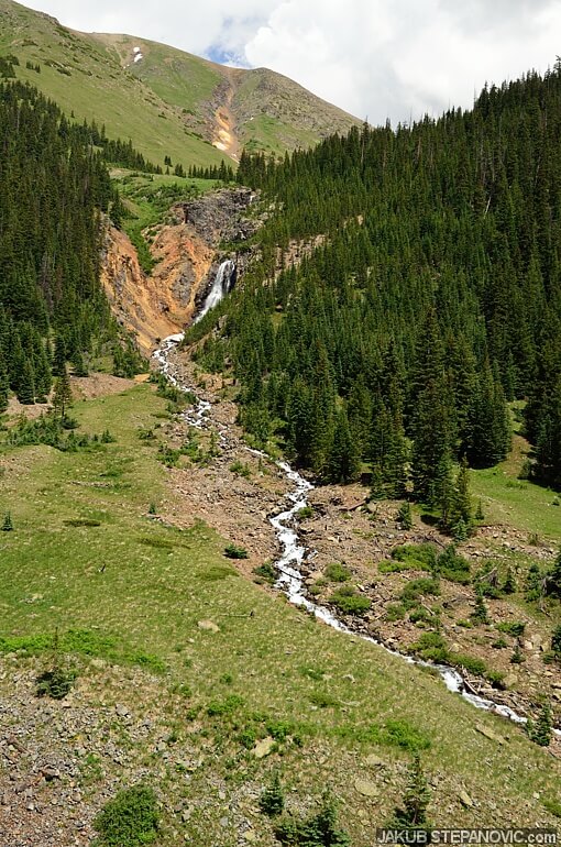
..and some waterfalls, oh yes, and the lake, too.
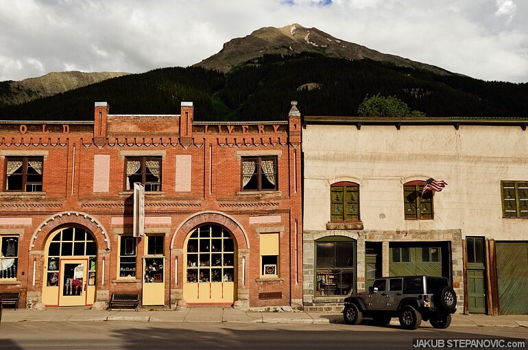
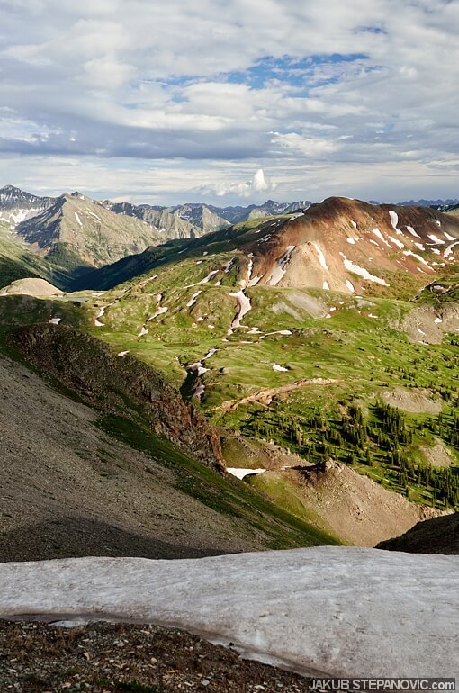
For the afternoon, I planned to get on the Alpine Loop and drive to Lake City. On the way there, I stopped in Animas Forks, which used to be another mining settlement back in the late 1800s. However, the industry switched, and nobody stayed here to maintain the village. The place is a ghost town today.
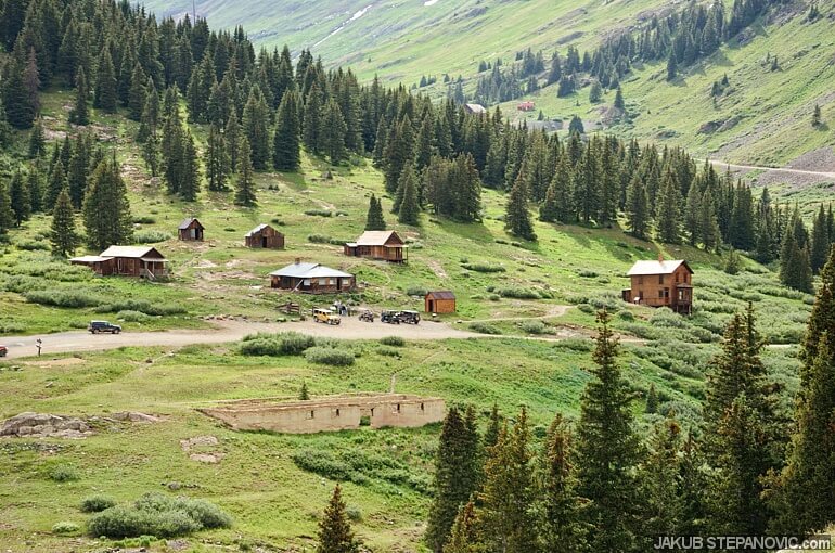
It is an interesting place; you can check nearly all the buildings from the inside. But I was keen to see the peaks around more than the human-made structures. The idea was to get up the Engineer Pass, the northern leg of the Alpine Loop. However, after yesterday's experience with the Ophir Pass, I decided to first check out the trailhead on foot. Sure enough, not too far into the trail, I saw a couple of obstacles that were a bit too high for my car's approach and breakover angles. I'd love to drive up there, but I needed the car to be capable of taking me all the way home, and breaking it here was the last thing I wanted.
Hmm. But Engineer Pass should offer 360 degrees of brilliant views, which I really wanted to see! Not willing to give up on it, I opted to hike there. The issue is that the distances here are as large as the mountains around, so hiking to explore what's behind the curve can mean hiking for half a day. Moreover, it was already late afternoon, and the day was slowly coming to an end. So, I looked around, counted my chances, and started hitchhiking.
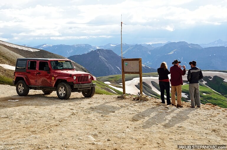
That's right! And there you go, the pass plus the good people who gave me a lift.
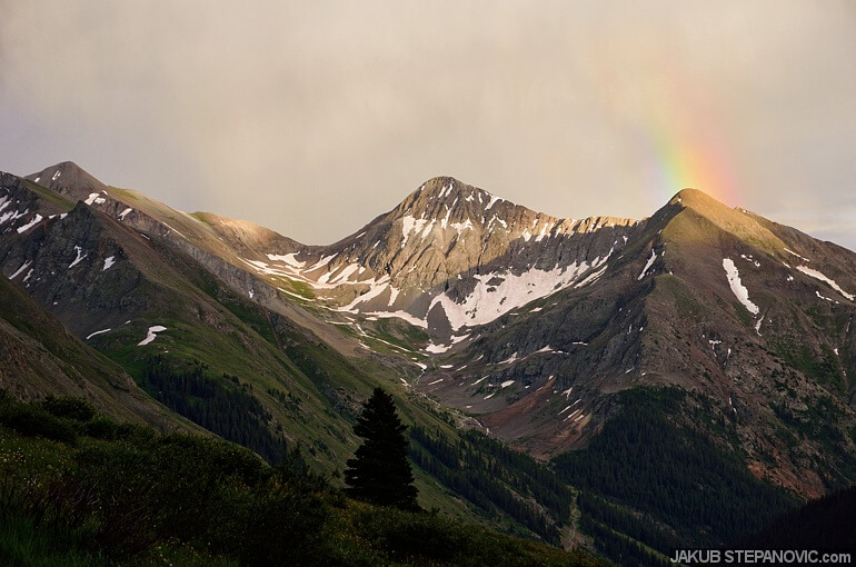
From here, I just walked back to the valley, which proved a fantastic decision. Everything was breathtaking. This area is absolutely...umm.. just see yourself:
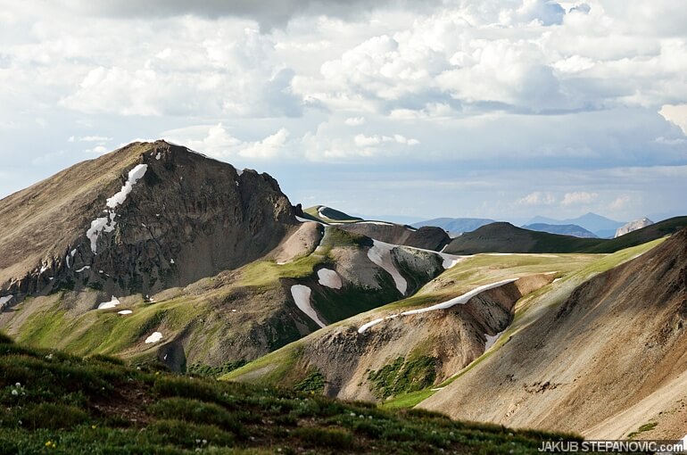

If this would be the very only thing I saw the whole trip, I'd be happy. Getting down, the sun-colored surroundings in everchanging layers of pretty light, ending with a rainbow.
When I got back to the Animas Forks, the sun was gone already. The ghost town suddenly earned the "ghost" portion; there was nobody but me and some marmots.


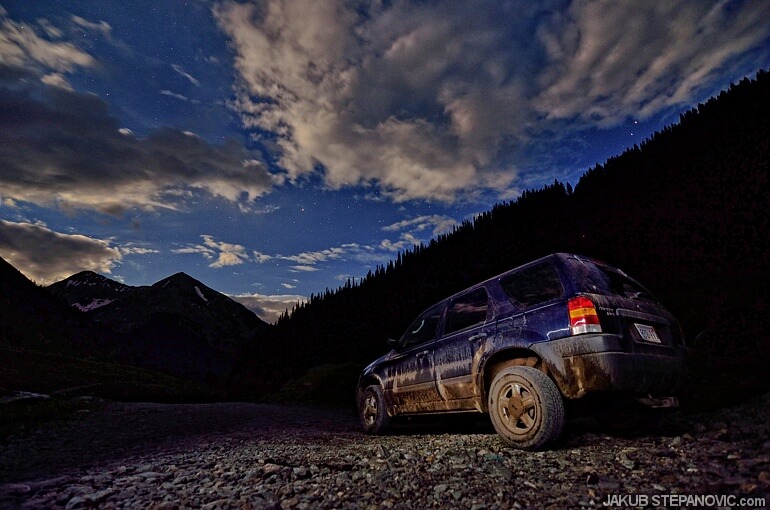
Then I drove a bit further and found a good spot to camp.
Day 7: New Heights
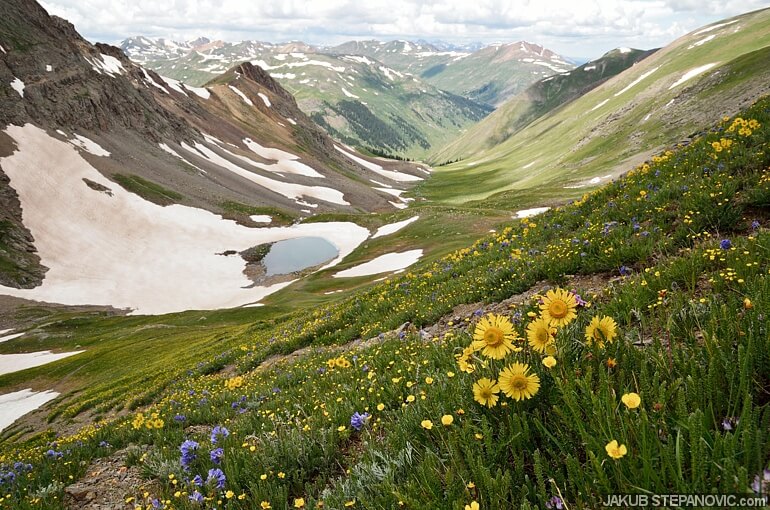
Since my plan to continue to Lake City over the mountains failed, I had to devise an alternative. After a quick glance over the map, I was set: Let's hike to the American Basin.
The footpath started climbing immediately. Here's a pic of my car – not from a plane, just the trail went up this steep.
In less than 2.5 miles (4km), the trail climbs around 2620ft (800m). Here, at an elevation of over 13,000 feet, my brain had some struggles convincing my lungs to work.

But I was rewarded soon.
The pass to the basin is just under 4000m above the sea. That round number is like the continental divide marker... And since I came all the way here, might as well use the opportunity to reach it...

Climbing up to 4000m somehow felt like reaching the pinnacle of the trip. Indeed, with road to Lake City crossed out of my plan, I had to drive a detour around the mountains to be able to eventually return to KS. So, the rest of the day was behind the steering wheel.

Day 8: Dignified Departure
At this point, I headed eastbound towards home. But that didn't mean that it couldn't be full of scenic sites to finish the trip in style.
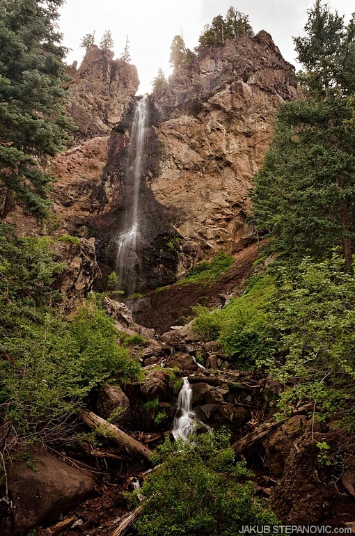
I started the day with a short trail to Treasure Falls, and I continued driving toward the last item on my bucket list: the Great Sand Dunes.
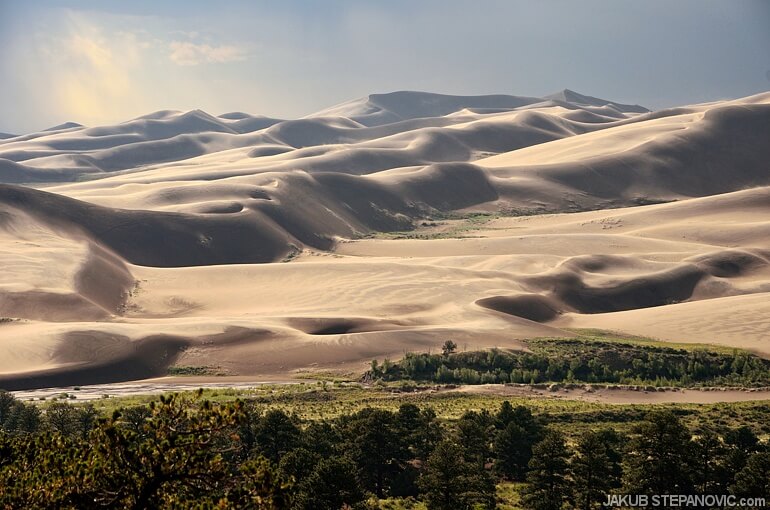
After I did some hiking there, I returned to the road and witnessed another neat sunset.
Time to find another prime place to spend the night.
Day 9:
Towering mountains gave way to flat horizons, and some hours later I got home again.
And that was it. If you have any questions, get in touch. And if you enjoyed this article, you might also like my other road trips or other posts from Blog Archives. Thanks for reading!
Comments are closed.