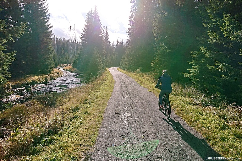
Cycling through Sumava's dense forests.
Located at southern Czechia's border with Germany, Sumava is one of Europe's oldest mountain ranges. As a result, the mountains are mostly rounded, with hardly any rocky, dramatic landscapes. Yet, the range has many interesting elements: it forms a major drainage divide between the North and Black Sea, and, perhaps, the most compelling aspect for me, it has the most contiguous area of forest in Central Europe. Besides occasional meadows and a few cities, trees go as far as one can see.
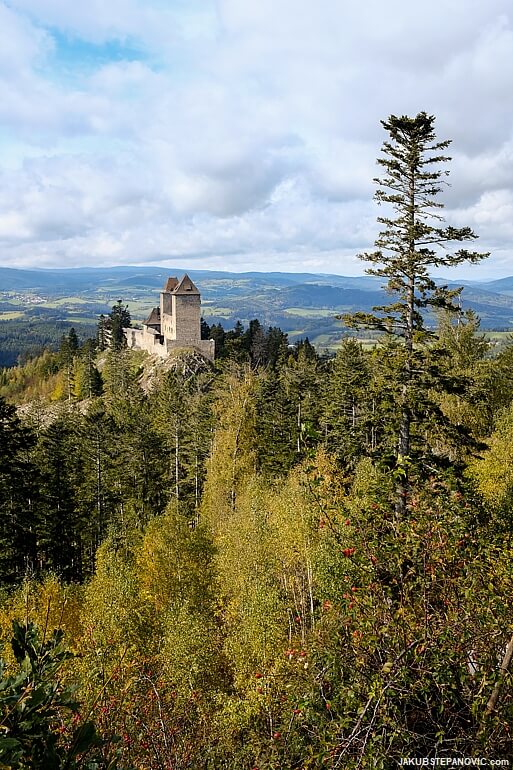
Overlooking the northern Sumava with Kasperk Castle from the 14th century.
There's something great about visiting the woods. Even scientific evidence proves that being around trees improves concentration and memory while lowering blood pressure and reducing stress — something I could use a lot this year! While the woodlands in Scotland are beautiful, they cannot match the density or scale of Sumava's forests. And so, when my friend suggested Sumava as the destination for a weekend getaway earlier this month, the goal was set. We set off to bike through its Czech portion, Bohemian Forest.

We arrived in Modrava, a village with a great location to explore the range. It was a cold but sunny evening, so before heading to bed, we followed Vydra River to look around and to stretch a bit after the travels.
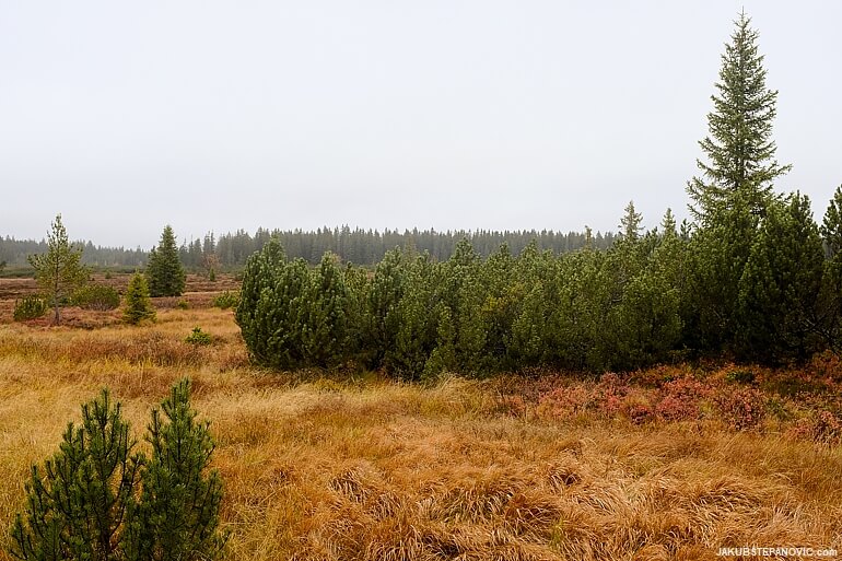
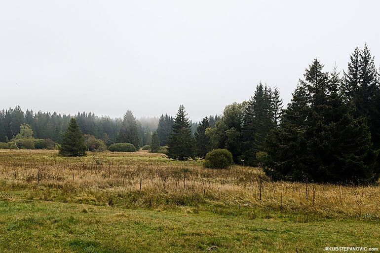
The next morning was warmer, but dense greyness covered the sky — such is Autumn. Regardless, the trees growing from the moist ground made up for a rather neat set.
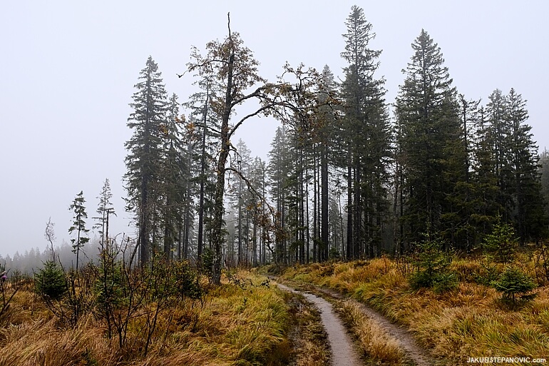
We hit the road to make a loop around a few boglands.
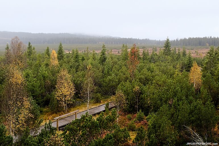
Jezerni Slat (which translates into something like Lake's bog).
The Sumava national park has quite strict use of land - people can go only on marked paths, some of which are even closed for cyclists. On the other hand, most of the paths are paved or gravel roads with a smooth surface.
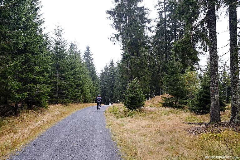
It's fantastic for roadies, but I felt like the NP management forgot about us mountain bikers. The area could use more singletracks, which would be cheaper and have less impact on the landscapes compared to the paved highways they constructed. But since I knew this fact beforehand, I brought semi-slick tires and enjoyed it anyway.
Vltava Springs
We stopped by the spring of Vltava, the longest river in the Czech Republic, and continued to what used to be Sumava's highest village, a former lumberjack settlement, Bucina. But instead of a finding thriving touristy town, there are reminders of the troubling past that the region went through during the 20th century.
Sumava used to be mostly populated by Germans. However, they were expelled from Czechoslovakia after the end of the Second World War, and while Czechoslovakia repopulated other former German settlements, this area soon turned into the Iron Curtain's forbidden zone, and nature reclaimed most structures. Bucina is a few yards from the national borders, and here, the border fortification is reconstructed.
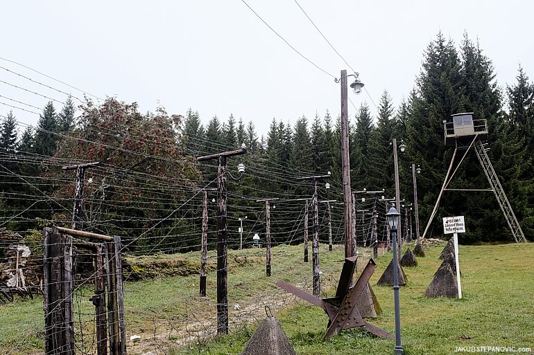
Looking at the gloomy scene brought an unexpected train of thought. On the one hand, it is mad to imagine that political powers established such isolation and that it functioned here until just a few decades ago. But on the other, the idea of rigid separation is still very much alive in many countries worldwide. Similar walls exist and are even being built as I write this, and some people celebrate them as the best thing for their country.
The artificial division is still visible even without visiting the area in person. If you look at hiking maps of the range, the German part, Bavarian Forest (the oldest national park in Germany, by the way), has much more advanced trail network infrastructure than the Bohemian Forest on the Czech side.
Our loop then continued through Fürstenhut, now called Knizeci Plane, another deserted village. The only thing that's left is the foundations of a church with a renewed cemetery.

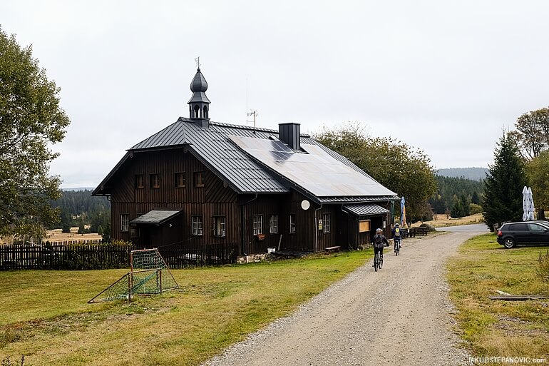
A tad further, one house got rebuilt, and conveniently, they serve food there. Lunchtime!
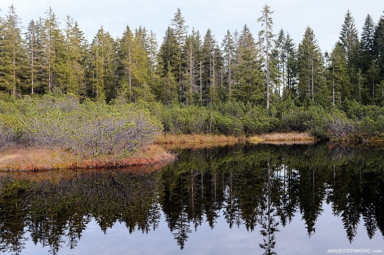
From here, we descended through more appealing landscapes into Chalupska Slat, a stunning-looking bogland with a lake.
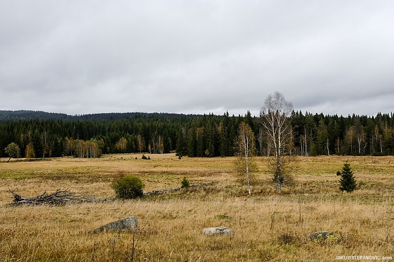
Chalupska Slat
Chalupska Slat was the last point of interest of the loop, and so we started our return to Modrava. The clouds cleared, and the sun saturated the colors around.

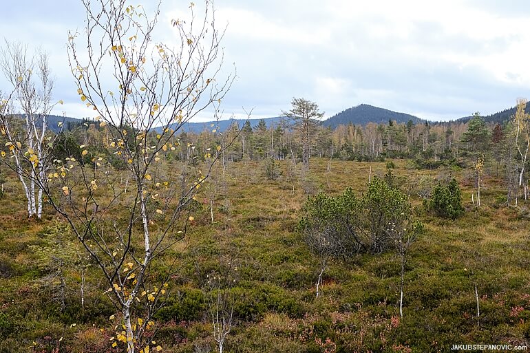
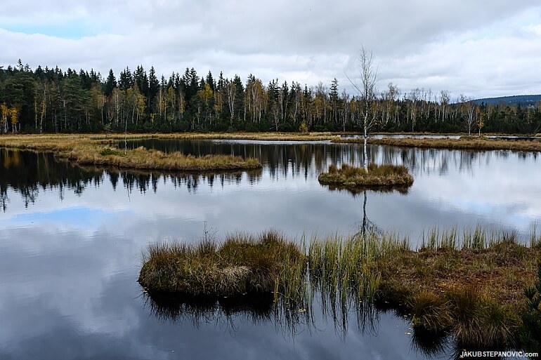
Having the time and good weather, we decided to extend the trip by a detour to another bogland area with lakes: Trijezerni Slat.

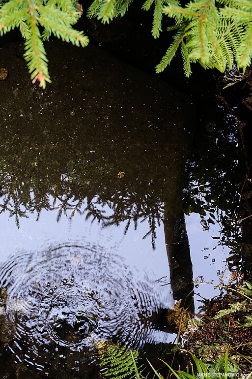
The water appeared nearly black due to the dark peat bed, but it was clean and calm, reflecting the forest behind it. And in the evening, we had it all to ourselves.
We fully enjoyed the peacefulness of the fading daylight, as the weather forecast hinted that tomorrow might not be this quiet...
Click for the second part of the trip here.
Alternatively, you might also enjoy my previous posts about mountains, or about biking...
|
|
Thanks for reading!
Comments are closed.